Bruno Nepomuceno
interesting information
Informações interessantes
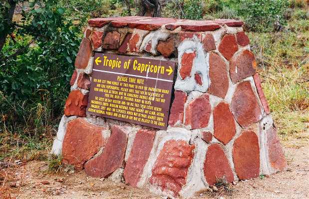
Entre o "Mopani Rest Camp" e o "Shingwedzi rest camp", a estrada "Shingwedzi - Mopani Rd" (H1-6) passa pela linha imaginária do Trópico de Capricórnio. A linha é materializada na estrada por uma marca feita com pedras. Há uma placa com um mapa e explicações bem interessantes sobre a existência e o nome desse Trópico.
O Kruger National Park é enorme e bastante alongado do norte para o sul. Quem viaja de um extremo ao outro do parque pode reparar a mudança progressiva da vegetação. Por exemplo, ao norte do Trópico do Capricórnio notamos o aumento significativo das gigantescas árvores baobab. Enquanto a parte sul dessa linha possui uma vegetação muito parecida com o cerrado brasileiro.
Ali nesse punto é autorizado sair do carro para tirar fotos "at your own risk". Bom para esticar as pernas depois de tanto tempo no carro fazendo safári. Mas saiba que o local não é cercado, então fique atento ao risco de animais perigosos estarem por ali.
As coordenadas GPS do local são: -23.4389267,31.3417072 (Google Maps)
Among the "Mopani Rest Camp" and "Shingwedzi rest camp," the road "Shingwedzi - Mopani Rd" (H1-6) passes through the imaginary line of the Tropic of Capricorn. The line materialized on the road for a brand made with stones. There is a plate with a very interesting map and explanations about the existence and the name of the Tropic. The Kruger National Park huge and quite elongated from north to south. Who travels from one end to the other park can repair the gradual change of vegetation. For example, north of the Tropic of Capricorn we note the significant increase of the giant baobab trees. While the southern part of the line has a very similar vegetation in the Brazilian cerrado. Ali that authorized punto out of the car to take pictures "at your own risk." Good to stretch the legs after so long in the car making safri. But know that the place in the fenced, so be aware of the risk of dangerous animals are there. The GPS coordinates of the location are: -23.4389267,31.3417072 (Google Maps)


+2

