alejandro santos sanchez
Good hiking and fishing
Buen senderismo y pesca
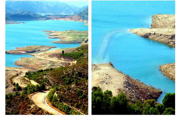
A 50 kms de Valencia , por al a-7 dirección Albacete , salida 862 llegas al embalse de Tous . Pasando en nuevo pueblo de Tous a unos 6 kms llegaras a una bifurcación donde entras al embalse o por detrás donde se accede a las compuertas pero no es posible pasar . Si sigues la carretera te lleva hasta abajo del pantano y donde estaba situado el antiguo pueblo de Tous . Allí la gente va a pescar y hacer deportes acuáticos , se puede divisar ruinas del antiguo pueblo , el antiguo castillo y si el nivel del agua esta bajo sobresale el campanario de la antigua iglesia del pueblo .Nosotros hicimos una ruta de senderismo PRV 263 , para ellos bajamos hasta el embalse y empezamos la marcha allí subiendo por la carretera asfaltada por donde habíamos venido en coche, a unos 6kms había una bifurcación que nos dirige a La Hereta y el Cabezon del Mellao, para mi era un poco aburrido el ir por asfalto ,mientras tuvimos la experiencia de ver varias cabras subir por delante nuestro, no es difícil te encuentres con ellas. seguimos recto y pasando La Hereta esta la dirección para ir hasta el Cabezón del Mellao, hay empieza la verdadera senda por Montaña, llegamos hasta el Cabezón desde donde se veía todo un paisaje increíble del pantano a lo lejos. Bajamos siguiendo las indicaciones hacia el pueblo viejo ,la fuente del Chorrillo , el mirados de Terrabona y barranco de Fornales ,a partir del mirador de Terrabona hay que tener cuidado ya que el sendero se hace muy abrupto y empinado .Bajamos hasta el barranco cruzamos el pequeño rio que había y al otro lado ya se podía ver la antigua cañería que llevaba el agua a tous , una cañería muy rustica de Barro , siguiéndola bajamos de nuevo al pantano donde habíamos situado el coche , en total unas 4 horas y 15 kms de ruta.
A 50 km from Valencia, for the A-7 direction Albacete, exit 862 Tous reservoir arrive at. Moving in new village about 6 miles Tous'll come to a fork where you enter the reservoir or behind where you enter the gates but can not pass. If you follow the road takes you to the bottom of the swamp and where it was located the ancient town of Tous. There people go fishing and water sports, you can see ruins of the ancient village, the old castle and if the water level is low stands the belfry of the old village church. We did a hiking trail PRV 263, for They went down to the reservoir and started the march there coming up the paved road we had come by car, about 6kms had a fork that leads us to the Hereta and the Mellao Cabezon, for me it was a bit boring going for asphalt while we had the experience of seeing several goats climb ahead of us, not hard you are with them. continue straight and passing the Hereta this address to go to the Mellao Cabezon, there begins the true path by Mountain, we reached the Cabezon where everything looked amazing scenery far away swamp. We went down following the signs to the old town, the source of Chorrillo, the seen of Terrabona and Fornales ravine, from the viewpoint of Terrabona must be careful because the trail gets very steep and steep. Went down to the ravine crossed the small river that had and the other side and you could see the old pipe that carried water to tous a very rustic pipe Barro, following her back down to the swamp where we had located the car, a total of about 4 hours and 15 kms from route.


+10


